Table of Contents (click to expand)
Millions of years ago, a continent-continent collision created the world’s tallest range of mountains, along with an entire range of mountains made of rock salt deposits.
It’s 326 BCE and Alexander the Great’s army is resting near the banks of the River Jhelum after their last battle with King Porus. They suddenly realized that Alexander’s beloved horse couldn’t be found nearby.
After a quick search, they found the horse licking a mountain rock. Upon closer inspection, Alexander’s army realized that it was made of salt! They took the salt rocks with them and introduced the phenomenon to the rest of the world.
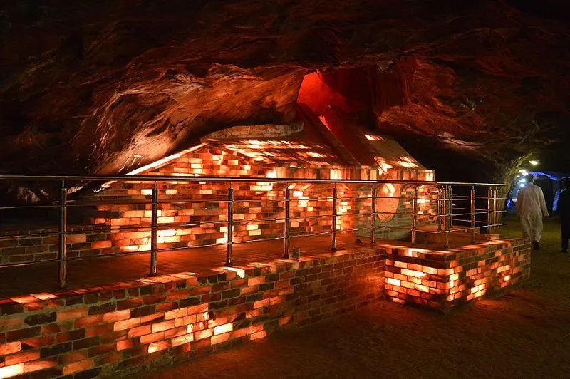
According to local legend, that’s how the salt deposits at Khewra in present-day Pakistan—home to Himalayan Pink Salt—were first noticed by outsiders. Commercial mining at Khewra didn’t begin until much later, under the Mughal era and then on a larger scale during the British Raj in the 19th century.
Is this a true story or just a legend? We may never know. What we will know by the end of this article is… How did pink salt end up in a landlocked mountain range so far away from the sea?
However, before we scale the Salt Ranges of the Himalayas, we need to understand the series of geological events that led to the formation of the world’s tallest mountain range.
Recommended Video for you:
The Continental Jigsaw
The cross-section of Earth that we usually see in textbooks represents the crust, mantle, and core as uniform segments, like the layers of a triple chocolate cheesecake.
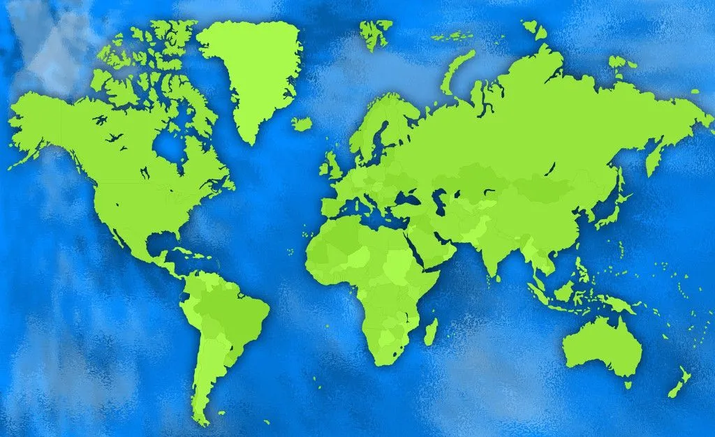
The world map, however, tells a different story.
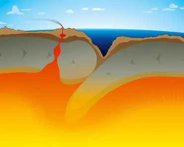
If you look at the eastern coastline of South America and the western coastline of Africa, their edges seem to match up like the pieces of a jigsaw puzzle. It is as if they were once part of a land that broke into different pieces… which is exactly what happened!
The continental land we live on isn’t a uniform solid shell. It is broken up into large pieces called tectonic plates—made of both continental and oceanic crust—that ride on top of the asthenosphere, the hot, ductile upper layer of the mantle. The asthenosphere isn’t actually liquid magma; it’s solid rock that flows very slowly, like extremely stiff toffee, over geological timescales.
Contrary to what our intuition might say, these tectonic plates aren’t stationary. They are always on the move, drifting away or towards each other, depending on the direction of the underlying magma current. However, their movement is so slow (a few centimeters every year) that we never feel physically feel it.
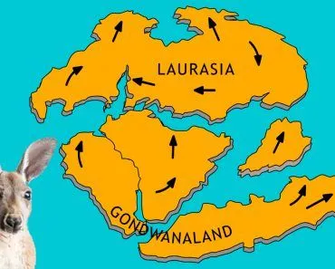
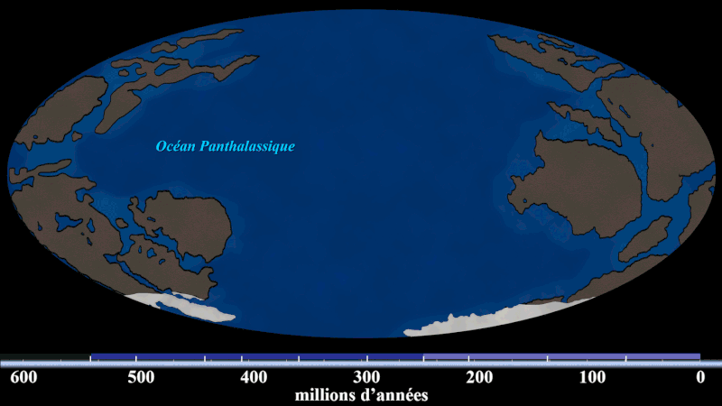
Roughly 200 million years ago, during the Jurassic era, a geological event (that occurred over millions of years) known as continental drift caused the supercontinent Pangea to break apart. The tectonic plates that made up Pangea were moving away from each other, and the slowly moving plates lumped into two supercontinents—Laurasia and Gondwana. Fast forwarding a few 100 million years, Laurasia split into two parts—North America and Eurasia (Asia and Europe).
Eventually, Gondwana also split into 5 different chunks— South America, Africa, Australasia, Antarctica, and the Indian subcontinent. All these pieces began moving toward where we find them today on our maps.
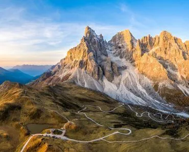
The rise of the Himalayas
During this global relocation process, the tectonic plate of the Indian subcontinent was nudged north toward Eurasia. The subcontinent started moving towards modern-day Tibet at a speed of 150 millimeters per year. As the tectonic plate moved towards the Asian tectonic plate, the oceanic floor of the Indian plate started sliding beneath the former. As a result, the Tethys Ocean that separated the land masses kept shrinking and the seabed moved upwards.
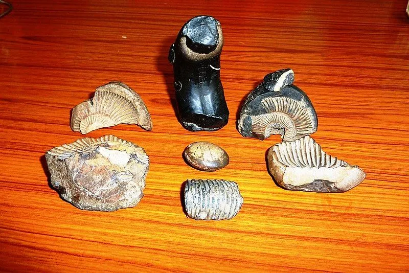
That was until approximately 50 million years ago; when the continental land masses of both plates were about to collide with each other, something changed! Instead of one plate going beneath the other, the Tibetan and the Indian plate began to rise together upon colliding. And then from the bottom of the already shallow Tethys rose—The Himalayas. The presence of ancient marine life and palm tree fossils high in the Himalayas reinforces the oceanic/coastal origins of the mountains.
Recent studies, however, tweak that series of events a little. Paleomagnetic measurements (amount of ancient magnetism preserved in rocks) can help scientists figure out the place of origin of certain rocks. Earth’s magnetic field changes from one place to another, as does the magnetic signature of the minerals in rocks.
Scientists have discovered two different values; one points to an oceanic Trans-Tethyan subduction zone, and the second is to the Eurasian Zone. This means that the Himalayas were the result of two collisions. First, the Indian subcontinent collided with the oceanic Trans-Tethyan subduction zone, and then it collided with Eurasia.
So what does this have to do with pink salt?
Salt without an ocean
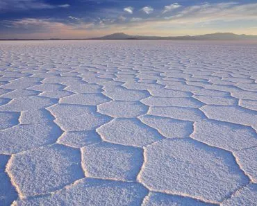
The answer is that Himalayan Pink Salt is really, really old sea salt—far older than the Himalayas themselves. Long before the India–Asia collision, an ancient shallow sea covered the region of present-day Pakistan during the Ediacaran to early Cambrian period (roughly 500–600 million years ago). As that sea slowly evaporated in the hot, arid climate, the dissolved salt crystallised on the seabed and built up into a thick evaporite layer—what geologists today call the Salt Range Formation.
Then, hundreds of millions of years later, came the role of plate tectonics. As the Indian plate ploughed northwards into Eurasia, those buried Cambrian salt beds were uplifted and shoved southwards along thrust faults—riding piggyback on the rising mountains. The result is the Salt Range of Pakistan, where ancient rock salt now sits high above sea level. So the Himalayas didn’t create the salt; they simply lifted a salt deposit that had already been waiting for half a billion years.
The salt also picked up traces of other minerals from the surrounding rocks during all of this geological churn. The pink colour itself comes mostly from iron oxide (hematite)—the same compound that gives rust its reddish hue. Smaller amounts of magnesium, calcium, potassium, and other minerals are present too, but it is iron that does most of the visual work, painting the crystals in shades that range from pale blush to deep salmon.
The 21st century saw a boom in the popularity of Himalayan pink salt, as health and fitness enthusiasts couldn’t seem to get enough of these “healthier” alternatives to common table salt. While pink salt does contain beneficial minerals, it is only in trace amounts, not enough to drive significant health benefits.
If we were to weigh the amount of Himalayan pink salt mined every year against the entire Empire State Building, the former would win by a few hundred tons. Health benefits or not, the uniquely pretty-in-pink salt, nearly ~400,000 tons of it, finds its place across the globe in kitchens as a seasoning, in spas as a soaking salt, and on coffee tables as salt lamps.
So, next time you season your food with some Himalayan salt or relax in the cozy glow of a salt lamp, take a moment to appreciate the gift that an ancient sea left for us before vanishing from the face of the Earth!
References (click to expand)
- India drift | MIT News | Massachusetts Institute of Technology. news.mit.edu
- The Salt Range and Khewra Salt Mine. World Heritage Site
- Formation of the Himalayas. Tory
- Hussain, S. A., Han, F. Q., Ma, Z., Hussain, A., Mughal, M. S., Han, J., ... & Widory, D. (2021). Origin and Evolution of Eocene Rock Salts in Pakistan and Implications for Paleoclimate Studies: Insights From Chemistry and Cl Stable Isotopes. Frontiers in Earth Science, 9, 644485.
- MI Anjum. Thermoluminescence study of Pink Himalayan salt from .... Elsevier