At similar latitudes, the US East Coast is colder than the West Coast because prevailing westerly winds blow cold continental air offshore, so the warm Gulf Stream cannot moderate the East Coast in winter. On the West Coast, those same westerlies arrive pre-conditioned by the Pacific, which is cooled in summer by the California Current and wind-driven upwelling and warmed in winter by stored ocean heat — keeping coastal temperatures mild year-round.
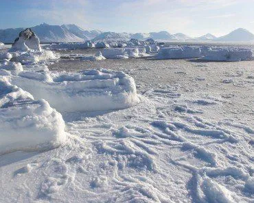
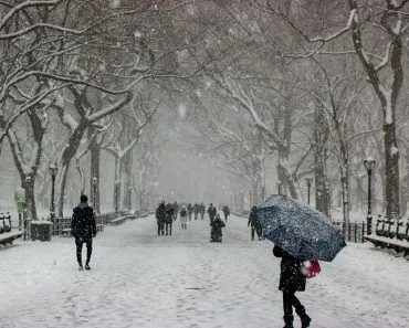
When a deep winter cold snap hits the United States — frozen waterfalls, thousands of cancelled flights, frostbite warnings, and burst pipes from Texas to Maine — the headlines almost always describe the East Coast and Midwest. New York can be buried under a foot of snow while San Francisco, at roughly the same latitude as Washington D.C., sees a chilly but rainy 50°F afternoon. So why does the eastern half of the country bear the brunt of winter while the West Coast stays comparatively mild?
The pattern repeats almost every winter. Polar-vortex disruptions — like the stretched-vortex event of January–February 2025 and the deep cold wave of January–February 2026 — repeatedly drive Arctic air into the eastern United States. The cities that take the biggest hit — heaviest snowfall, lowest temperatures — sit near the East Coast.
Meanwhile, the West Coast typically rides out these episodes with little more than rain showers and overcast skies. The reason isn’t latitude — Los Angeles, San Francisco, and Seattle all sit at roughly the same latitudes as cities along the East Coast. It comes down to a combination of prevailing wind direction, ocean currents, and the way the continent itself shapes the atmosphere above it.
Recommended Video for you:
What Gives The East Coast Its Extra Chill?
There are several factors responsible for the chilly climate on the east coast of the United States, one of them being ocean currents.
Ocean currents have a massive effect on Earth’s climate. They are the natural thermostats that keep the temperature of land in check. For instance, equatorial regions receive large quantities of sunlight. This means that these areas should get warmer and warmer as more sun falls on it, but this isn’t always the case. Ocean currents play a major role in keeping the temperature in check. These currents and winds transport heat from lower latitudes to higher latitudes, i.e., near the poles.
The ocean has the capacity to store large quantities of heat on its surface, which is then transported by the currents. This process is a natural climate controller, as it facilitates the transfer of heat from the Equator to the poles.
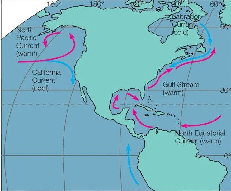
Another major factor is the prevailing westerlies — the band of winds in the mid-latitudes (roughly 30°–60°N) that, despite the name, blow from the west toward the east. They originate over the North Pacific and travel across the entire North American continent before reaching the Atlantic.
Land has a much lower heat capacity than ocean water, so it heats and cools far more quickly. In winter, the North American interior becomes intensely cold while the surrounding oceans stay relatively warm. As the prevailing westerlies sweep eastward across the continent, they pick up the chill of frozen plains, lakes, and mountains. By the time that air reaches the East Coast, it is cold and dry; when it meets the moist air over the Atlantic, it can dump heavy snow on cities like Boston, New York, and Washington D.C.
The crucial difference between the two coasts is the direction of this airflow. On the West Coast, westerlies arrive over the ocean and bring marine air onshore, so the Pacific’s temperature governs coastal weather. On the East Coast, those same westerlies blow continental air offshore — carrying the Gulf Stream’s heat out to sea (and ultimately toward Western Europe) instead of letting it warm the eastern United States.
In fact, climate research by Richard Seager and colleagues at Columbia University’s Lamont-Doherty Earth Observatory has shown that the Gulf Stream’s presence actually amplifies the East Coast–Western Europe temperature contrast. The warm current sets up large-scale stationary atmospheric waves (Rossby waves) that draw cold Arctic air southward over eastern North America, while pushing warm air northeastward toward Europe. Seasonal heat storage by the ocean and these atmospheric waves — not direct heating from the Gulf Stream itself — explain why London is far milder in January than New York at almost the same latitude.
What Are The Governing Factors Of West Coast Weather?
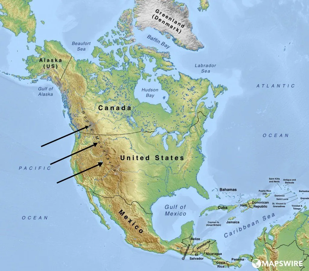
The weather of the West Coast has 2 major influencers – the Pacific Ocean and the mountain ranges along the coast. These two work in unison to create a very unique weather pattern.
The Pacific Ocean is one of the deepest oceans on Earth, and is known to have sudden drops in its sea bed, resulting in highly unusual topography. The water near the coasts has a substantially deep seabed, which results in water experiencing a steep temperature gradient.
Sunlight has a greater area and depth for dispersion than land. The water at the surface is warmer than the water at greater depths. The mountains that line the coastline have an effect on both the East and the West. The water over the oceans is relatively warm. It heats up its surrounding air, resulting in warm, moist air. This air rises up over the Pacific and moves towards the land. As the air rises upwards, it cools and condenses into rain. This results in the west coast receiving high levels of precipitation towards the west of the mountains. The weather of cities such as Seattle and Portland is governed by this phenomenon. This is why the West Coast is largely characterized by temperate conditions in the summer and winter.
How Does The Polar Vortex Drive East Coast Cold Snaps?
Even with prevailing winds and ocean currents stacked against it, the East Coast would not normally see Arctic temperatures every winter. The extra ingredient that turns a cold week into a coast-paralyzing event is the polar vortex.
The polar vortex is a band of fast-moving, frigid air that circles the Arctic high in the atmosphere — strongest in the stratosphere, roughly 10–50 km up. When it is healthy and tight, the vortex acts like a fence, holding the coldest air pinned over the pole. According to the U.S. National Weather Service, the term refers specifically to this circumpolar circulation, not to a single “storm” that wanders south.
Trouble begins when the vortex is disturbed. Atmospheric waves rising from below can warm the polar stratosphere by tens of degrees Celsius in just a few days — a phenomenon called a Sudden Stratospheric Warming (SSW). An SSW can either split the vortex into two lobes or stretch and displace it. Either way, the polar jet stream that normally walls off Arctic air becomes wavy and weak, and lobes of frigid air spill southward into the mid-latitudes — most often over eastern North America and East Asia, where the geography of the continents anchors the waves.
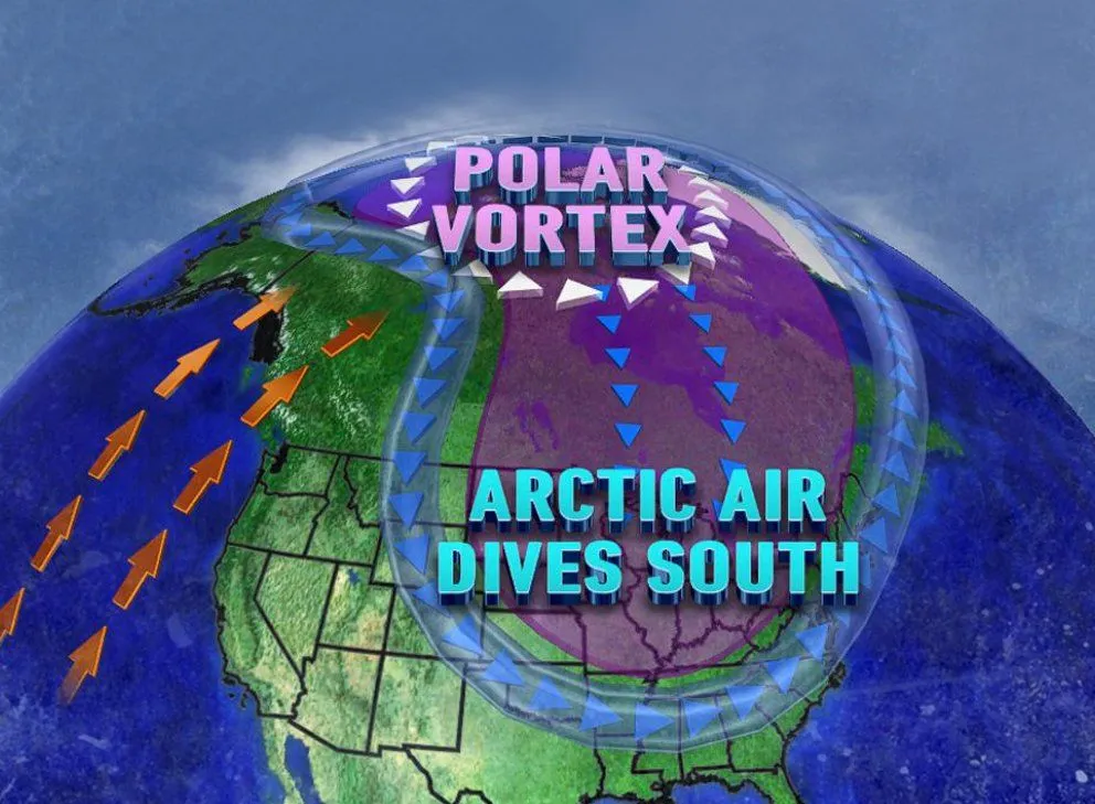
This is the mechanism behind nearly every memorable East Coast cold snap of the last decade. The January 2014 “polar vortex” outbreak, the January 2019 cold wave, the January–February 2025 stretched-vortex event — documented in PLOS Climate as one of the most impactful Northeast winter episodes since 2020–21 — and the January–February 2026 cold wave that pushed snow into Texas and Florida all trace back to disturbances of the stratospheric polar vortex. The West Coast, sheltered by the Pacific and the coastal mountain ranges, mostly watches from the sidelines.
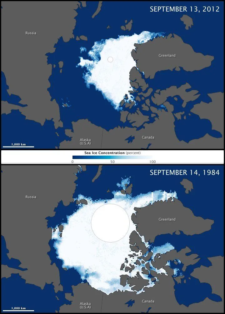
Many people understandably wonder how record cold can coexist with global warming. The answer is that local cold spells and global warming describe different things. The planet’s long-term average temperature has risen, but Arctic warming has actually accelerated faster than the mid-latitudes — a process called Arctic amplification. Some recent studies (for example Hamouda et al. 2024 in Geophysical Research Letters) suggest this weakens the equator-to-pole temperature gradient and makes the polar vortex more prone to disruption, although climate models still disagree on whether such disruptions will become more frequent. Either way, a single brutal week in New York is not evidence against climate change.
To sum up: the temperature gap between the two US coasts is, at its core, geography. Prevailing westerlies, a continent-sized landmass, the cold California Current and warm Gulf Stream, and the unusual response of the atmosphere to that ocean configuration combine to give the East Coast harsh winters and the West Coast mild ones — even at identical latitudes. Polar-vortex disruptions decide how brutal any individual winter feels, and a warming Arctic appears to make those disruptions more likely, not less.